 Urban Analytics
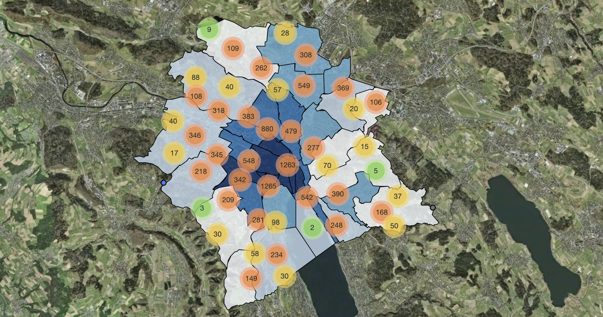
Spatial Analysis of Urban Infrastructure Reports
Cleaned, processed, meaningfully structured and spatially analysed raw open data about infrastructure problems from the ZüriWieNeu platform – revealing patterns in maintenance demand across city districts.
 Environmental Risk
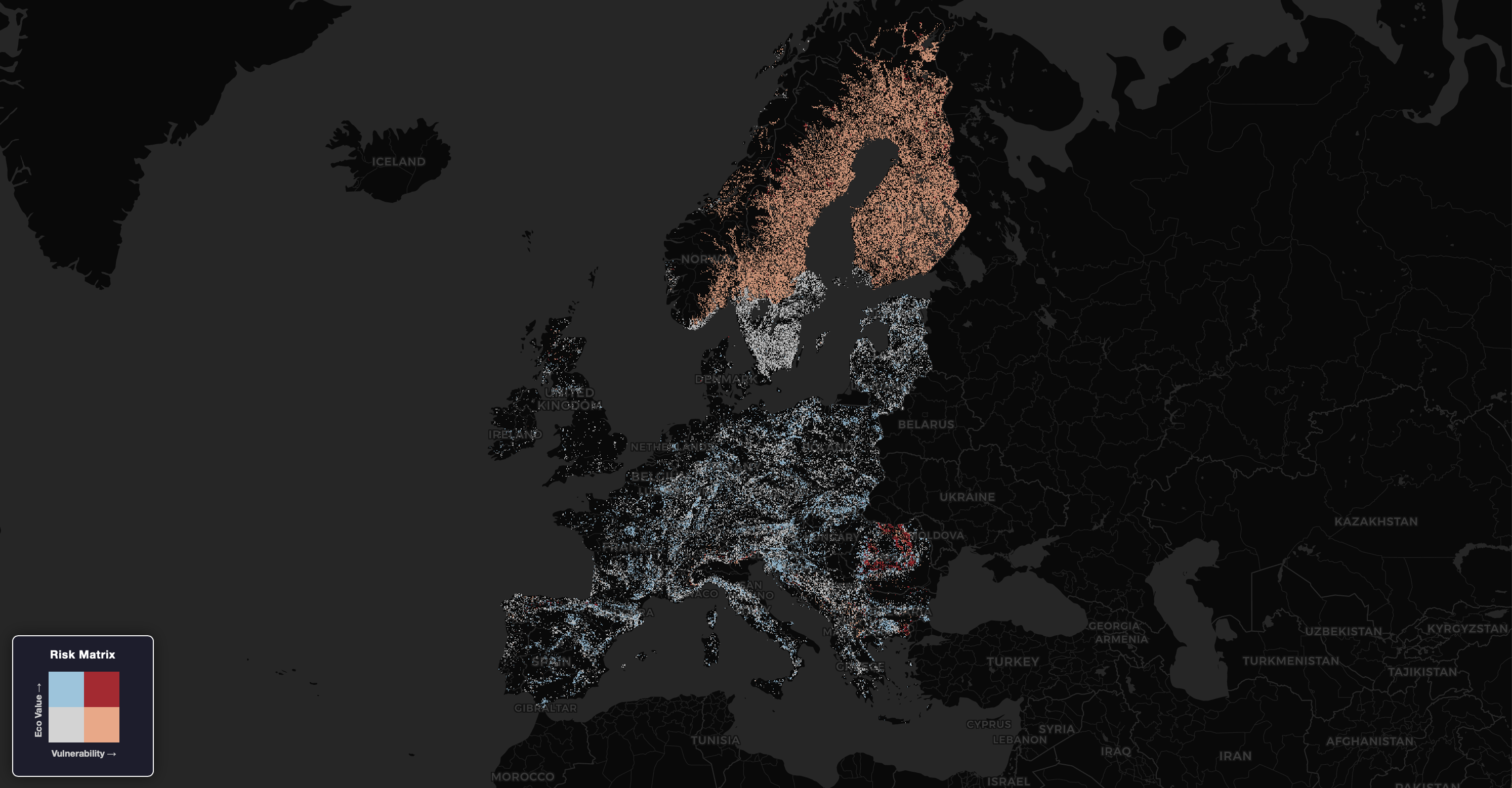
Producing a Wildfire Risk Indicator for Europe
Built a Europe-wide wildfire risk indicator using a bivariate environmental index. Combined ecological value and vulnerability to identify high-priority hotspots — demonstrating scalable geocomputation across continental datasets.
 Spatial Algorithms
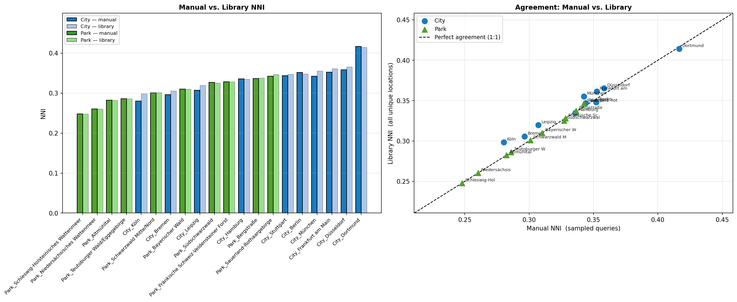
Clustering of Flickr Photos in German Cities and Parks
What actually happens under the hood of common spatial algorithms? Flickr photo data across German cities and parks is used to implement spatial algorithms from scratch — without libraries — to understand the principles behind them.
 Geocomputation & AI
Geoparsing Early COVID-19 Reports via LLM
Automated extraction of unstructured location data from WHO reports. Built a Python pipeline using pdfplumber and the Gemini API to extract and geocode place names — turning PDF documents into mappable spatial data.
 Remote Sensing
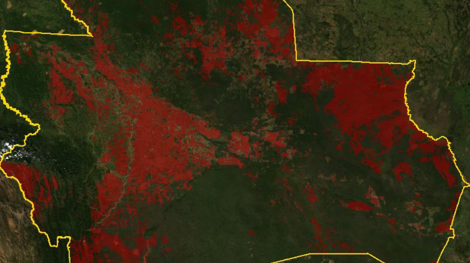
Forest Fire Time-Series Analysis — Bolivia (2000-2024)
Do wildfire patterns in Bolivia show long-term trends — and where? MODIS satellite data from 2000 to 2024 is analysed via Google Earth Engine to identify spatial distribution and multi-year fire dynamics.
 Hazard Modelling
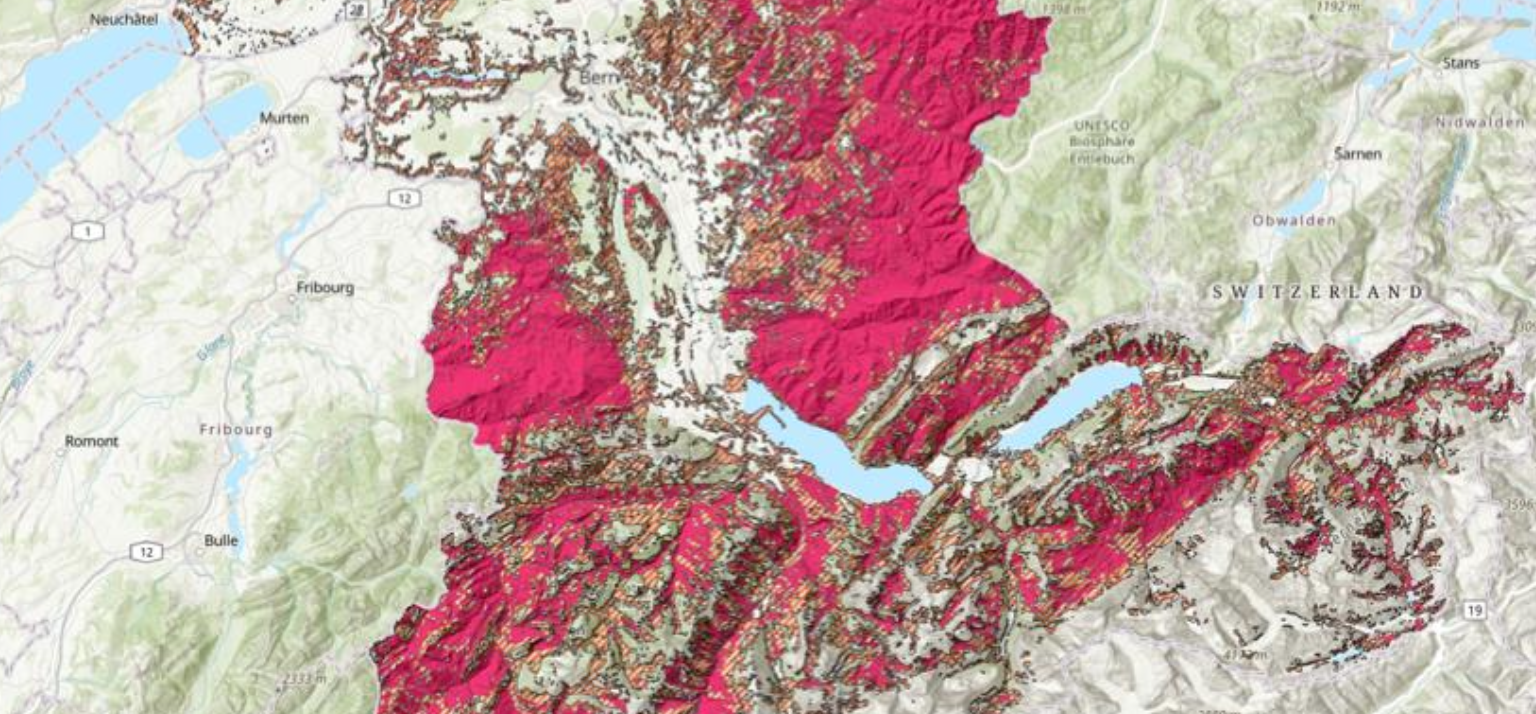
Mapping Landslide Susceptibility for Bern
Which areas of Canton Bern are most susceptible to landslides? A hazard map based on the Frequency Ratio method combines slope gradient, geology and land use to calculate a Landslide Susceptibility Index (LSI) — implemented in ArcGIS Pro.
 Spatial Cognition
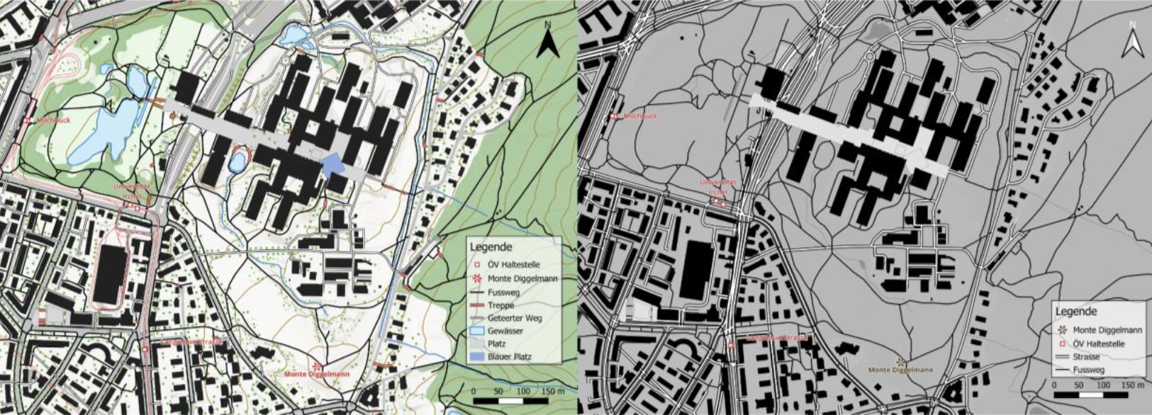
Wayfinding Analysis - The Impact of Map Design
Does map design measurably affect how well people navigate? GPS tracking data and statistical analysis in R were used to empirically test whether different map styles influence orientation efficiency in the field.
More Projects Coming Soon
Ongoing and future projects will be added here.